 |
A spectacular shot of Greg Johnson's team tracking a large tornado near Tilston, Manitoba Monday evening.
(Tornado Hunters) |
It was a wild weather night across southern Manitoba on Monday as a strong low pressure area lifted north from the Dakotas into Saskatchewan. The ingredients were perfect for supercell thunderstorms and mother nature did not disappoint. A large wedge shaped tornado with multiple vortices was on the ground for nearly 3 hours according to Environment Canada. The tornado, up to 4km wide at times, was largely in rural areas of southwest Manitoba near Tilston. Storm chasers in the area recorded winds in excess of 120mph (200km/h). They were likely stronger closer to the tornado with pavement being scoured from highways. At first light we will see if more damage has occurred. Hail the size of baseballs also fell in the region along the North Dakota border. Heavy rain on the backside of the storm produced flooding in Saskatchewan including Regina, where more rain fell yesterday (78.2 mm), than in the last three months. Flooding was also reported in my old home town of Gravelbourg, Saskatchewan. More storms are forecast today in Manitoba, with strong winds in Saskatchewan.
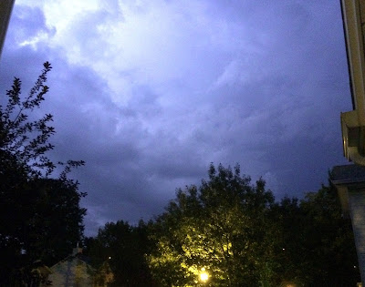 |
| Lightning illuminates the sky on L'Ile Perrot last night. (ValleyWeather) |
Meanwhile southern Quebec had a warm and humid day Monday followed by strong thunderstorms last evening. The storms rolled across the Island of Montreal and L'Ile Perrot after 8pm. Heavy rain and frequent lightning occurred, putting on quite a show. I measured 16 mm of rain at my home in less than 30 minutes along with vivid lightning, lasting over one hour. Lightning is extremely dangerous, and this was highlighted last night as a cyclist was struck in the Rosemont district of Montreal. He was listed in critical condition this morning after going into cardiac arrest. The storms also knocked out power to thousands in Quebec. A fire in Brossard was blamed on a lightning strike and there were reports of hail in St Hubert. Numerous trees were knocked down across the Beauce along with flooding. Between 50-100mm of rain fell near the New York State border in Huntingdon.
The warm and humid weather will persist through Thursday with more storms likely each day. A heat advisory is in effect stretching from southern Ontario into southern Quebec. High temperatures at or above 30C along with high humidity, will make it feel more like 40C. Stay hydrated and keep an eye on the sky for late afternoon and evening storms.
 |
Street flooding from Gravelbourg, Saskatchewan after more than 75mm of rainfall Monday.
(Gravelbourg Fire Department) |


No comments:
Post a Comment