 |
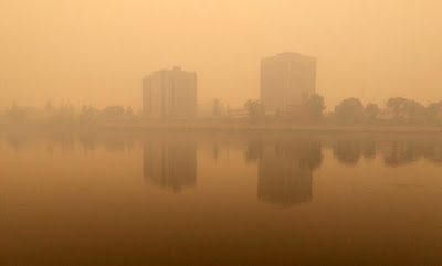
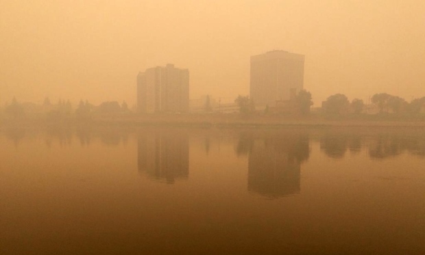
| Cities such as Saskatoon, Regina and Moose Jaw had terrible air quality on Monday from fierce fires burning in the NWT. (CTV News) |
The same weather pattern remains locked in place across Canada as we approach the end of June. We have a big ridge of high pressure in the west pumping hot and dry air north from the desert southwest into B.C., Alberta and Saskatchewan. A deep trough exists in the east with frequent fronts, cooler and wet weather. Montreal and most of southern Quebec and Ontario can't seem to go more than day without some form of rain.
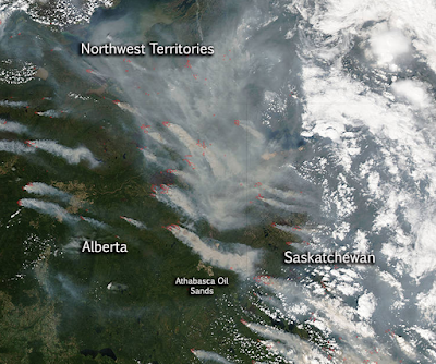 |
| Smoke plumes generated by large forest fires in northern Canada drift south across western Canada and into the northern US. (NASA) |
Meanwhile over 135 brush and forest fires are burning across the NWT and northwest Saskatchewan producing dense smoke that has settled across Saskatchewan and into Montana and the northern US. On Monday many locations in Saskatchewan including Saskatoon, Moose Jaw and Regina had visibilities under 1km for much of the day. The smoke is generating very poor air quality, limiting outdoor activities as well as making driving dangerous. Temperatures have soared to over 35C (95F) in many locations with numerous all time June record highs broken in interior B.C. and Alberta. There is no relief in sight with hot weather forecast through the week across western Canada.
Here in Montreal sunshine today will allow for temperatures to rise into the middle 20's. Sadly another frontal system will bring showers and thunderstorms tonight into the Canada Day holiday. After a wet Wednesday with thunderstorms, high pressure will bring sunshine and warmer weather Thursday into this upcoming weekend..

No comments:
Post a Comment