Special Weather Statement posted for most of eastern Ontario and portions of southern Quebec for snow and blowing snow. Winter Weather Advisory for the St. Lawrence Valley of New York and northern Champlain Valley of NY & Vermont. No warnings yet for Montreal but it will be an "advisory" type snowfall if Environment Canada used such terminology.
The Details...
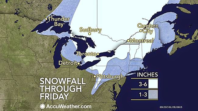
Low pressure will move from the Great Lakes today down the St. Lawrence Valley bringing snow and blowing snow to Montreal, Ottawa and Quebec City starting late today and lasting into Friday. The storm is rather disorganized in nature but will still bring us more snow than we have seen at any other time in January. We start the day at -20C (-4F) on L'Ile Perrot, clear and cold once again, a theme that has been replayed countless times this January. Clouds will increase today with snow developing by late afternoon from Kingston to Cornwall before moving into Montreal by the evening commute. Once it starts it will snow steadily until noon or so Friday. Expect a good 10cm (4 inches) in most locations with 15cm (6 inches) right along the St. Lawrence River, including metro Montreal. Temperatures will warm today to -4C (25F) and up to -1C (30F) early Friday morning, before an arctic front plunges the temperature down to -13C (9F) by days end. It will turn windy as well Friday, gusting up to 50km/h causing blowing snow in Ontario and Quebec. Driving may be challenging at times. Skies will slowly clear Friday night setting up a sunny but very cold weekend. Lows will be near -22C (-8F) with highs no better than -13C (9F).
No comments:
Post a Comment