I am not certain where our summer has gone but I hope it returns soon. Officially at Trudeau Airport, Montreal has managed only four 30C (86F) days this summer, two each in June and July. Only one day of those days was over 32C (90F), that was July 1st. Last year we managed nine 30C or warmer days in July alone.
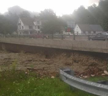 |
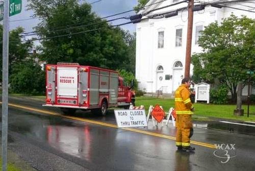
| Major flooding in Chester, Vermont on Monday. (Chester Fire Department) |
It was just a cold and miserable day on Monday across southern Quebec and Ontario. Our temperature only managed to reach 18C (65F) for a high and that was early in the day. Most of the afternoon we were stuck at 16C (60F) with a cold northeast wind and rain. I recorded 11.7 mm of rain on L'Ile Perrot with a two day total of 27 mm (just over 1 inch). Other regions to our south had much more with 25-50mm (1-2 inches) falling from the Eastern Townships south into Vermont. In southern Vermont major flooding occurred around Chester and Andover in Windsor County. The rain swelled rivers damaging roads and bridges as well as several homes. Power was cut to over 1700 Green Mountain Power customers. The low pressure responsible for the lousy weather is now in northern Maine with high pressure building in briefly today. Partly cloudy skies can be expected from eastern Ontario into Montreal along with milder highs of 23C (73F), still well below normal. Wednesday and Thursday will see more clouds with the chance of a shower or thunderstorm as the upper low remains nearly stationary over the Gulf of St. Lawrence or retrogrades slightly. Temperatures will warm a little to 25C (77F) but we will have the ever present chance of a shower or thunderstorm into the weekend.
No comments:
Post a Comment