 |
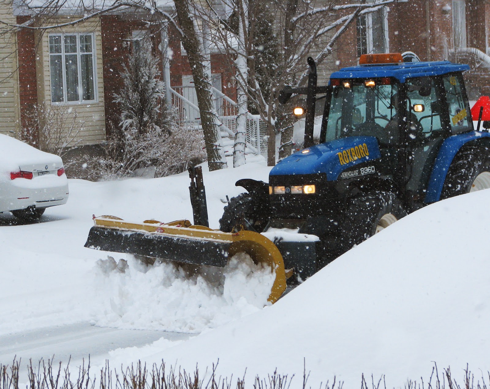
| Snow clearing crews across southern Quebec were kept busy again on Sunday moving aside 10-20cm of heavy wet snow. Lets hope this was the last time this season we will need the use of plows. (Valley Weather Photo) |
The question posed to me on a daily basis now is when will we get spring, when will it get warmer? My answer has been soon, but with a disclaimer. This winter has been long leaving behind plenty of ice on the Great Lakes and St. Lawrence River, and piles of snow all around the region. This will definitely slow the onset of warmer weather as the evaporating ice and snow will keep temperatures cooler and produce more cloud. We only managed 0C today in Montreal while places with sunshine like Toronto reached a warmer 6C, and Ottawa 3C.
A perfect example of our slow start to spring was the storm that swept across Quebec on Sunday. Montreal received between 10-15cm of wet snow in just a few hours. It was windy as well with gusts at Trudeau Airport close to 70km/h through the middle part of the day. Places just south of the US border reported rainfall. Just the extra degree or two in temperature difference in Montreal meant snow over rain. The good news is we have some milder air starting Monday with clearing skies by noon. Temperatures will respond most of this week under the warm April sun, reaching daytime highs of plus 6 to 8C (43 to 48F) in Montreal. Overnight lows will drop just below the freezing point between -2 and -4C (25 to 28F). The next chance for precipitation will come late Tuesday or Wednesday in the form of a few snowflakes or showers. More steady mixed precipitation is likely by next weekend.
A perfect example of our slow start to spring was the storm that swept across Quebec on Sunday. Montreal received between 10-15cm of wet snow in just a few hours. It was windy as well with gusts at Trudeau Airport close to 70km/h through the middle part of the day. Places just south of the US border reported rainfall. Just the extra degree or two in temperature difference in Montreal meant snow over rain. The good news is we have some milder air starting Monday with clearing skies by noon. Temperatures will respond most of this week under the warm April sun, reaching daytime highs of plus 6 to 8C (43 to 48F) in Montreal. Overnight lows will drop just below the freezing point between -2 and -4C (25 to 28F). The next chance for precipitation will come late Tuesday or Wednesday in the form of a few snowflakes or showers. More steady mixed precipitation is likely by next weekend.
No comments:
Post a Comment